

-
Role
Prime Consultant
Landscape Architect
Services
Landscape Architecture
Climate Resilience
Nature-based Design
Visioning
Client
Vancouver Park Board
Collaborators
KWL
EXP
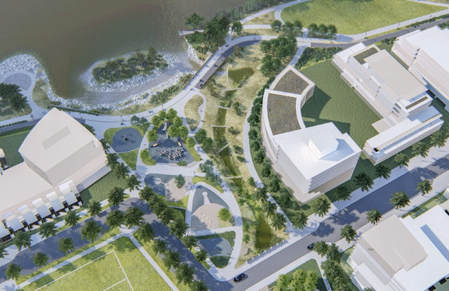
The East Fraserlands riverfront park is located in the southeast corner of Vancouver along the Fraser River. This park is designed to seamlessly integrate flood management infrastructure into its design. Working closely with the City of Vancouver and engineering subconsultants, Space2place has created a park that not only protects against sea level rise but also enhances the unique qualities of living in a riverfront community.
The park is made up of sections that serve the surrounding community, including a long stretch of foreshore park that aims to improve the biodiversity and ecology of the river. It features large, flexible areas for informal sports, community events, and cultural celebrations, as well as a children's playscape for local families. The park also celebrates the rich cultural stories of the site, including the history of the sawmill and the relationship of First Nations with the land and river, through park elements and public art. One of the main features of the park is Sanctuary Island, a wildlife habitat separated from the rest of the park by a tidal marsh/slough.

View of the foreshore park with the constructed habitat island in the centre of the new park.

The intertidal wetland in the foreground connected to the tidal influences of the Fraser River.
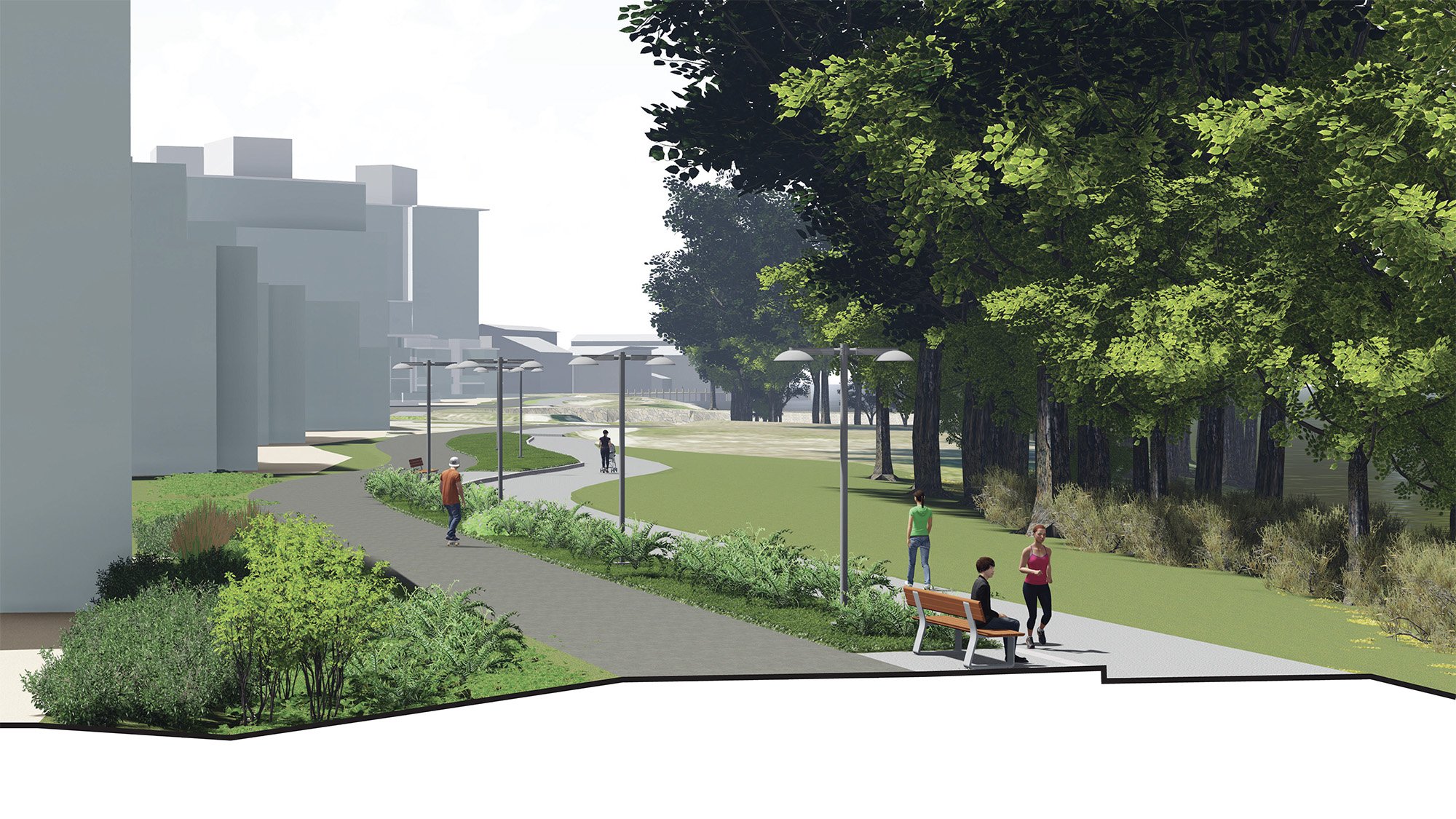
The dike is integrated into the multiuse trail along that runs parallel to the river.

The dike under construction. Due to the soil conditions along the river, piles were installed to make the dike resilient to earthquakes.
The Central Park is designed to host flood water during extreme events. This helps to improve biodiversity and add complexity to the Fraser River shoreline. A “non standard” dike was used in this area and integrated into the playscape. The yellow line highlights the flood infrastructure.

The flood wall through the playscape under construction. The sheet pile wall will be integrated into the design of the new playscape.

A lookout utilizes a remnant concrete foundation from an old sawmill crane. The lookout is aligned with a view to Mount Baker.
Visualization of flood levels today and in the future with 1 metre sea level rise.

The middle Kinross parks extend to Marine Drive perpendicular from the Fraser River.
Selected Process Photos
-
![]()
Preliminary concept
-
![]()
Sketch of preferred concept
-
![]()
3D study model
-
![]()
3D study model
-
![]()
3D study model
-
![]()
Preliminary grading
-
![]()
Planting study


